Geospatial technology is a term that encompasses a variety of tools, techniques, and methods used to collect, analyze, and interpret geographic data. It combines elements of geography, cartography, remote sensing, and information technology to provide spatial context to various data sets. This technology is becoming more and more important in daily life as society gets more and more data-driven. This article explores the nuances of geospatial technology, its applications, and its impact on various sectors.
Table of Contents:
Understanding Geospatial Technology
Definition and Components of geographic information systems

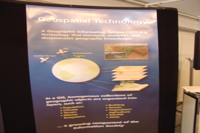
Geospatial technology refers to any technology that involves the geographic component of data. It typically includes:
- Geographic Information Systems (GIS): Tools that allow users to visualize, analyze, and interpret spatial data.
- Global Positioning Systems (GPS): Location-assured navigation systems based on satellites.
- Using the remote sensing: This is the technique of gathering data about a subject or region from a distance, typically with the use of airplanes or satellites.
These components work together to provide insights and understanding about spatial relationships in the environment.
Evolution of Geospatial Technology
Geographic information systems has its origins in cartography and the early stages of map creation. Over time, advancements in technology have significantly transformed how geographic data is collected and analyzed. The advent of satellite imagery, digital mapping tools, and the internet has accelerated the growth of this field, making it more accessible and impactful in various domains.
Importance of Geospatial Technology
The importance of geospatial technology plays a crucial role in numerous sectors. Here are some key reasons why its significance cannot be overstated:
1. Improved Ability to Make Decisions
In domains including environmental management, urban planning, and disaster relief, it provides essential data that aids in making informed decisions. By visualizing data in a geographical context, stakeholders can better understand trends, risks, and opportunities.
2. Improved Efficiency of Geospatial Technology
Businesses and organizations utilize geospatial technology to optimize their operations. For example, logistics companies can use GIS to determine the most efficient delivery routes, saving time and reducing costs.
3. Better Resource Management
Natural resource management benefits significantly from geospatial technologies. By analyzing land use, water resources, and biodiversity, authorities can implement sustainable practices and monitor changes over time.
4. Enhanced Communication through Geospatial Technology
Geospatial technology aids in visual communication. Maps and spatial data can convey complex information quickly and clearly, making it easier for stakeholders to understand critical issues.
Applications of Geospatial Technology in Everyday Life

1. Navigation and Transportation
One of the most visible applications of geospatial technology in everyday life is navigation. GPS technology is embedded in smartphones, cars, and wearable devices, helping people find their way efficiently. This has transformed how we travel, allowing for real-time traffic updates and alternative route suggestions.
2. Urban Planning and Development
Cities are becoming increasingly complex, requiring effective planning tools. Urban planners utilize GIS to analyze land use patterns, assess environmental impacts, and plan for infrastructure development. This technology helps in creating sustainable and efficient urban environments.
3. Environmental Monitoring Through Geospatial Technology
It plays a vital role in environmental conservation. Remote sensing tools are used to monitor deforestation, track wildlife, and assess the health of ecosystems. This data is essential for policymakers and conservationists working to protect natural resources.
4. The Public Health
Geographical information systems are utilized in the public health domain to monitor disease outbreaks, pinpoint health inequalities, and schedule medical interventions. For example, during the COVID-19 pandemic, GIS was instrumental in visualizing infection hotspots and vaccination progress.
5. Use of Geospatial Technology In Agriculture
Farmers leverage geospatial technology to optimize crop management. Precision agriculture uses GPS and GIS to analyze soil health, monitor crop conditions, and apply resources like water and fertilizers more efficiently. This leads to increased yields and reduced environmental impact.
6. Emergency Response
In emergency management, geospatial technology is crucial for disaster preparedness and response. GIS helps emergency responders assess damage, allocate resources, and plan evacuation routes. It enables a more effective and timely response to natural disasters.
7. Retail and Marketing
Businesses use geospatial data to understand customer behavior and optimize their marketing strategies. Retailers may choose the best sites for new businesses and customize their products to fit local demand by examining demographic data.
8. Real Estate
In the real estate sector, GIS tools assist agents and buyers in evaluating properties. By visualizing neighborhood demographics, property values, and amenities, stakeholders can make better-informed decisions.
Geospatial Technology Jobs
As the field of geospatial technology continues to expand, so does the demand for skilled professionals. Here are some common career paths within this domain:
1. GIS Analyst
GIS analysts work with spatial data to create maps and conduct spatial analysis. They are essential in various sectors, including urban planning, environmental management, and transportation.
2. Remote Sensing Specialist
These professionals focus on interpreting data collected from satellites and aerial imagery. Their work is vital for environmental monitoring and resource management.
3. Geospatial Data Scientist
With the growing importance of data analytics, geospatial data scientists analyze complex datasets to extract insights and inform decision-making. Their skills are increasingly sought after in industries like transportation, agriculture, and urban planning.
4. Urban Planner
Urban planners use geospatial tools to assess land use, zoning regulations, and infrastructure needs. Their work ensures that urban development is sustainable and meets the needs of the community.
5. Cartographer
Cartographers design and produce maps for various purposes, including navigation, education, and marketing. Their expertise in visualizing data is crucial for effective communication.
6. Environmental Consultant
These professionals use geospatial technology to assess environmental impacts and advise organizations on sustainability practices. They play a critical role in resource management and regulatory compliance.
Geospatial Technology Examples
To better illustrate the practical applications of geospatial technology, consider the following examples:
1. Google Maps
Google Maps is a popular example of how geospatial technology is integrated into everyday life. It uses GPS data to provide navigation, traffic updates, and location-based services, making it an indispensable tool for millions.
2. Environmental Monitoring Systems
Various organizations use remote sensing technology to monitor environmental changes. For example, NASA’s Earth Observing System tracks changes in land cover, climate, and natural disasters, providing valuable data for research and policy-making.
3. Smart Cities
Cities around the world are leveraging geospatial technology to create smart urban environments. Through IoT devices and GIS, smart cities monitor traffic patterns, manage waste collection, and optimize energy usage, improving the quality of life for residents.
4. Agricultural Drones
Farmers are increasingly using drones equipped with GIS technology to monitor crop health and optimize irrigation. This precision agriculture approach leads to better yields and reduced resource use.
5. Public Health Initiatives
Health departments use GIS to map disease outbreaks and track vaccination rates. This data is crucial for addressing health disparities and planning effective public health interventions.
Geospatial Technology Courses

For those interested in entering the field of geospatial technology, numerous educational opportunities exist. Here are some popular geospatial technology courses:
1. Introduction to Geographic Information Systems (GIS)
This foundational course covers the basics of GIS, including data types, spatial analysis, and map-making techniques.
2. Remote Sensing
Courses in remote sensing focus on acquiring and interpreting satellite and aerial imagery, including applications in environmental monitoring and urban planning.
3. Spatial Data Analysis
This course teaches students how to analyze spatial data using statistical techniques, providing valuable skills for various applications.
4. Geospatial Programming
For those interested in the technical aspects, courses in programming for geospatial applications cover languages like Python and R, which are commonly used in data analysis and GIS.
5. Cartography and Visualization
This course focuses on the art and science of map-making, emphasizing effective communication through visual representation of data.
The Impact of Geospatial Technology on Tourism
Destination Planning
It enhances tourism planning by utilizing Geographic Information Systems (GIS) to analyze data on attractions and transport. This allows planners to identify infrastructure gaps and optimize resource allocation, ensuring that destinations are both sustainable and accessible.
Traveler Experience Using Geospatial Technology
It enriches the travel experience through real-time navigation and personalized suggestions. GPS-based apps help tourists easily locate nearby attractions and services, while augmented reality (AR) offers interactive insights at landmarks, creating engaging and informative visits.
Conclusion
Geospatial technology is an essential aspect of modern life, influencing a wide array of sectors from transportation to public health. In addition to being widely used, its applications are also vital for deft decision-making and effective resource management. As the demand for geospatial technology jobs continues to rise, education in this field becomes increasingly important. By understanding the significance and applications of this technology, we can better appreciate its impact on our daily lives and the world around us. Whether through optimizing transportation routes or monitoring environmental changes, the possibilities and benefits of geospatial technology are vast and transformative.


